Näytetään tekstit, joissa on tunniste canyon. Näytä kaikki tekstit

sunnuntai 3. huhtikuuta 2016

Within the rock

The "White House" down in the canyon.
We visited the White House ruins. No, we didn't go to Washington DC, and as far as I know the residence of the U.S. President is in good condition. This somewhat less famous White House is situated in Arizona, near the town of Chinle, on Navajo lands and on the floor of a canyon. The canyon is called Tséyi, "A place within the rock", and the name that appears on white people's maps is Canyon de Chelly.

It is probably not as famous a canyon as the Grand Canyon, at least among Finnish tourists. For me, however, it was one of the most impressive places I've ever visited. Grand Canyon, of course, was that as well, but I learned that there are many kinds of canyons.
The floor of the canyon is covered in lush vegetation, but the rims are a dry desert.
The shape of Canyon de Chelly is very different from Grand Canyon, the latter follows the Colorado river for a long distance, whereas the former looks, on a map, like a gigantic dinosaur's footprint. It is winding, with many branches. The landscape in Canyon de Chelly  is completely different from Grand Canyon or the sandstone formations in Zion National Park.

Canyon de Chelly is remarkable not only for its natural history, but also human history. It contains traces of human habitation as old as 4000 years. The first people to make the canyon their home, ancestors of today's pueblo peoples of Arizona and New Mexico, are sometimes called the anasazi. The pueblo peoples of today may dislike that name, because in the Navajo language, anaasází means "ancient enemy". The Hopi, who today live west from Canyon de Chelly, call their ancestors hisatsinom, "the ancient ones": archeologists usually call them "ancestral puebloans". They seem to have left the canyon before first contact with Europeans, and the area was settled by the Navajo. The battle of Canyon de Chelly in 1864 was the last time that the Navajos took up arms to resist the military power of the United States.
Cultivated fields on the floor of Canyon de Chelly.
Today Canyon de Chelly is a National Monument, administered by the Federal government and the Navajo Nation in co-operation. In addition, it is farmland. There are fields and pastures of many Navajo farmers on the floor of the canyon. Farming in a rugged canyon, in the hot and arid Arizona climate, must be difficult and hard work.
Panorama of the Spider Rock lookout. Full-sized picture can be seen here.
A good road follows the canyon rim, and there are several viewpoints. Landscape is beautiful everywhere, but I found Spider Rock most impressive. It is a sandstone pillar, rising 240 meter (almost 800 feet) above the canyon floor. According to an old Navajo legend, it is home of the Spider Woman who taught the Navajo to weave cotton cloth.
Spider Rock.
However, the best thing about Canyon de Chelly is that the floor can be reached relatively easily. Most of the canyon is off-limits without an official guide, but there's one hiking route, the White House Trail, open for everyone. Even completely unathletic middle-aged couch potatoes like us survived with little difficulty. It probably was a smart thing to wait until late afternoon, so that the walls of the canyon created shade on the path. The heat of the noon might have been unbearable. Anyway, do carry plenty of water.
From the White House Trailhead. The White House Ruin can be seen on the bottom of the picture.
Astonishing sandstone formations.
It feels magical to be on the canyon floor, hard to describe or capture in a photo. Go and see yourselves!
According to archeologists, the White House was constructed around 1070 AD and abandoned about 1300 AD.
The Navajo legends tell us that the White House is inhabited by spirits called the Yé’ii.
On the canyon walls by the ruins, there are ancient petroglyphs.

We went within the rock on June 16th 2015.

lauantai 26. syyskuuta 2015

Horseshoe Bend & Antelope Canyon

Light and shadow in Antelope Canyon.
East of the Grand Canyon's Northern Rim the landscape changes rapidly. A Nordic like pine forest soon transforms to a hot desert, where strange sandstone formations rise over otherwise flat landscape. Less than two hours' drive from the Canyon is Navajo Bridge, the first bridge over the Colorado River east of Hoover Dam. The first bridge was built in 1929: before that, the river could only be crossed by a ferry, known as Lee's Ferry. Today there are not one but two bridges, the original one and the new bridge, built in 1995. Cars cross over the new bridge, the old one is used by pedestrians. Here the Colorado River is the border of Navajo Nation.

The New Navajo Bridge, picture taken from the old one.
A short distance northeast from the bridge, by route 89, lies Horseshoe Bend. This is one of the many natural phenomena in Arizona that are hard to believe in, even after seeing it with one's on eyes. The Colorado River makes a 270-degree turn around a sandstone rock. It's definitely worth stopping, if driving past. There's a parking lot by the route 89, and about half a mile walk to the bend itself from there. It's not a great distance, but feels much longer at least in the heat of June, climbing over a steep hill in soft red sand. By the way, most of Navajo lands seems to consist of that fine sand, and after your visit you will find it absolutely everywhere, including but not limited to your shoes, clothes and luggage weeks after returning home.

A fish-eye lens view of the Horseshoe bend. With conventional lenses I could not get a full view. I suffer from vertigo and there was absolutely no chance to get closer to the edge of the cliff..
A lizard runs away from the photographer in red sand.
Some twenty more minutes drive from Horseshoe Bend is yet another astonishing place, whose existence seems to go against reason and laws of nature, namely Antelope Canyon. Actually there are two of them, Upper and Lower Antelope Canyons. We visited the upper one. The lower one looks quite similar, if the pictures I've seen are to be believed. Both are administered by Navajo Nation parks. They can only be visited on a guided tour, and prices are a bit steep: the two of us paid almost 100 dollars.

Entrance to the Upper Antelope Canyon.
It was well worth the price, though, as the Canyon is very impressive. Not surprisingly, it is also very popular, and I have to say that it was a bit too crowded. With fewer visitors - a lot fewer - it would have been far more enjoyable. Of course, it's rather hypocritical for me to complain about it, as I was a part of the crowd. I strongly recommend timing your visit outside of holiday season, to a weekday and early morning, if at all possible.
The crowded Canyon.
Anyway, the light and shadow was an incredible sight.
Sandstone formations seemed surreal.
They say the light in the canyon is very different in the morning than in the evening - makes sense. Our visit was in early afternoon.
Our guide Shanderee Laughter demonstrating how the sandstone formations and Antelope Canyon came to be.
There's a far less pleasant landscape within sight of the Antelope Canyon, an enormous coal plant, the Navajo Generating Station. The plant and Kayenta coal mine are economically vital to Navajo Nation, providing money and jobs to a region suffering from high unemployment. On the other hand, the plant is the third largest source of carbon dioxide emissions in all of United States. The mines have caused, and continue to cause, serious environmental damage. Many think that the wealth and problems generated by the coal business are not distributed in a just and equal way.

The gigantic chimneys of Navajo Generating Station.
Below, a document about the Navajo coal business.


We visited Horseshoe Bend & Antelope Canyon on June 14th 2015

sunnuntai 6. syyskuuta 2015

Surrounded by Sacred Mountains

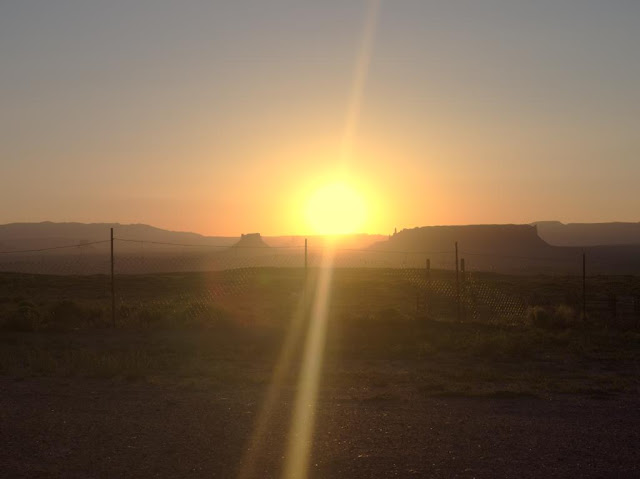
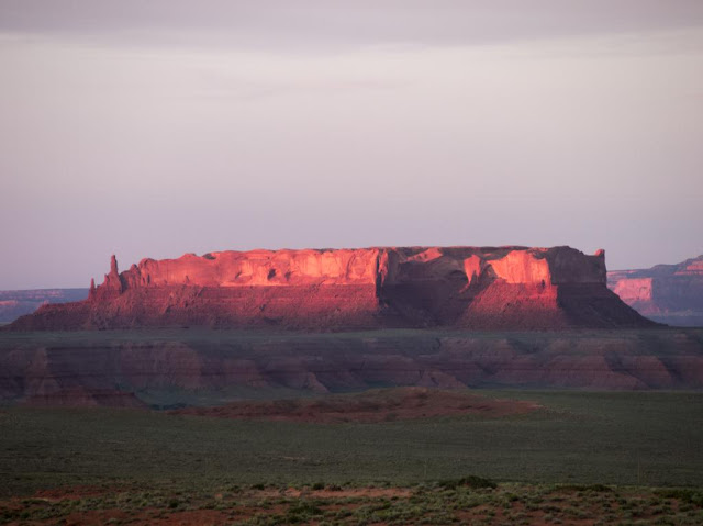
A Mesa on sunset. This is a typical landscape in the land bordered by the Sacred Mountains.
East of Grand Canyon is the homeland of the Navajo, who call themselves Diné, "the People". According to their own traditional origin story, the Creator has told them to live in their land bordered by four Sacred Mountains. Most of this land is today included in Navajo Nation, a self-governed territory of the Navajo. It occupies parts of three U.S. States, Arizona, New Mexico and Utah.

On our travels we prefer small private accommodations over chain hotels. For example the "Grandma accommodations" in the Balkans and small B&B's in Ireland offer great deals in regards to price, quality and, above all, ambience. This time we spent two nights on a farm near Many Farms village. We booked it through Airbnb. The place was rather basic - earth floor and no running water, but functioning WiFi. During our short visit we got at least some insight into modern day life among the Navajo, much more than we would have had we stayed in a roadside motel.

We stayed in a hogan, a traditional Navajo dwelling. The Arizona summer was hot, but even during the day the hogan remained reasonably cool. As the farm was situated in a high elevation on a mesa, it got almost chilly at night. We didn't need the wood-burning stove for heating, though, but I'm sure it's necessary in winter.
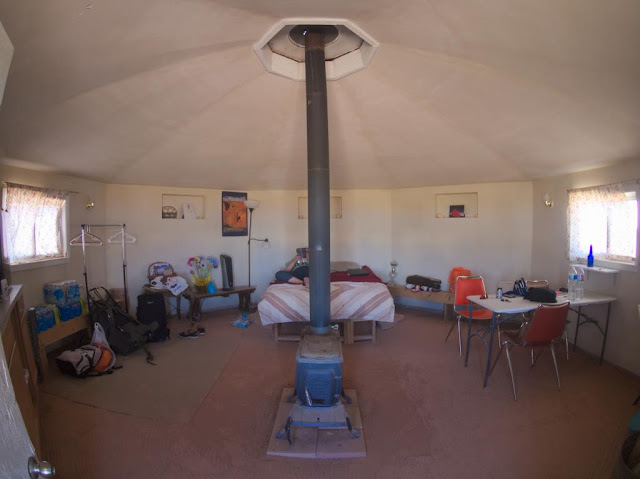
Hogan from the inside...
...and from the outside. This is a "female" hogan: a "male" one has a porch-like extension in front of the entrance. "Female" hogans are for accommodation, "male" hogans for ceremonial purposes. The entrance always faces east and the rising sun.
Our hogan was equipped with all necessary things for accommodation, but also with travel guides and books on the Navajo and their land. The surrounding landscape was incredibly beautiful. We took a walk in the evening, to a small canyon situated literally on the back yard, and were accompanied by our host's two friendly dogs. When it got dark, we got to see the stars without any disturbing artificial light. My personal highlight of our four-week trip was a morning coffee sitting in front of the hogan, the dogs and horses keeping me company, while Jóhonaa'éí (the Sun, literally "He who rules the day"), rose from behind  a mesa.
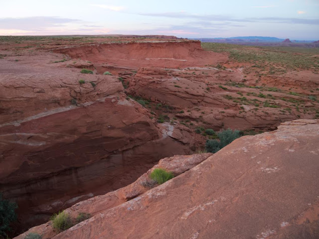
We don't have a canyon like this in our back yard.
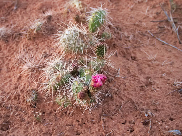
Blossoming cacti neither.
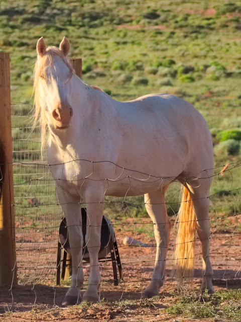
As an urban dweller I am unaccustomed to the company of white horses when I'm having my morning coffee.
"...the indian sun is rising instead of going down..." (Johnny Cash: Navajo)
Navajo Nation is the largest self-governing Native American territory in the United States. According to official statistics the Navajo are the second most populous Native people. They are more than 300 000, majority of whom speak Navajo at home. It seems that the existence of the Navajo as a nation is secure. I think it can be stated that they have been more successful in dealing with settlers from Europe than many other Native American peoples.

However, there are many tragic and horrible chapters in the history of the Navajo. The most sinister probably is "The Long Walk", a forced relocation by the U.S. Military to Bosque Redondo reservation in New Mexico in 1864-1866. The conditions in badly overcrowded reservation and on the way there were unbearable. Thousands died of hunger and disease. The relocation caused also spiritual suffering, since according to their traditional beliefs the Navajo were meant to live in the land the Creator gave them, the land bordered by the four Sacred Mountains, and it would be impossible for them to succeed elsewhere. In 1868 the Navajo leaders managed to negotiate a treaty granting them the right to return home. This is exceptional in the story of the United States, land once taken from Native Americans has not often been returned.
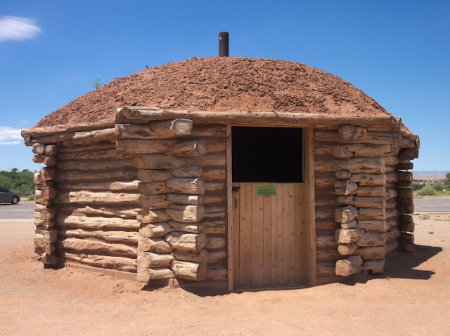
A historical hogan in the Canyon de Chelly visitor center.
There is also another interesting chapter in Navajo history connected to the U.S. Military. During the Second World War young Navajo men were drafted to signal troops an deployed on the Pacific front. Based on their complicated mother tongue, they created a radio signal code which the Japanese were never able to break. The impact of the "Code Talkers" to the outcome of the war was significant, and their effort for the United States is a great source of pride for many Navajos even today. There were Code Talkers from other Native American peoples, too, but the Navajo were by far the biggest and consequently most influential group.
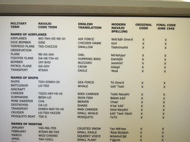
Navajo code explained in the Monument Valley museum.
Today the Code Talkers are remembered as national heroes, but during the war they were treated as second-class citizens. For example, in New Mexico the Native Americans were banned from voting until 1962. Most Navajos of the Code Talkers' generation were educated in Federal Indian Schools. There they were prohibited from speaking languages other than English. As schoolchildren they might have been beaten for speaking their own language. As adults they were awarded medals for it. Oh, the irony of history.

From a traveler's point of view, the Navajo Nation isn't that different from other regions of the Southwest United States. The small towns are no different than others in Arizona, Utah or New Mexico. However, alcohol is prohibited, like in most other Native American-governed areas. Spoken Navajo can be heard sometimes, also on  radio, but English is far more common. Like all Americans, the Navajos we talked to were very polite, helpful and friendly, and wanted to know where we are from. In one respect they were a little different than most other Americans: the Navajo generally speak less loudly. I understand that needlessly rising one's voice is considered impolite.

There's one thing connected to the Navajo self-government that may cause confusion fo the tourist. In the USA, the states can decide many things themselves, for example whether to observe the daylight saving time or not. Arizona doesn't, but the Navajo Nation does. Consequently, the Navajo are an our ahead of the rest of Arizona in the summer, but at the same time as all of Utah and New Mexico. As if that wasn't complicated enough, the Hopi, whose lands are completely surrounded by the Navajo Nation, observe the Arizona time. Make sure you consider this when asking about opening times and such!

The fusion of Navajo traditions and modern popular culture has created some interesting results, such as  Navajo Metal and a Navajo-language version of the original Star Wars movie. Generally speakin, I couldn't care less about any beauty contest, but I do respect Miss Navajo Nation, who has to prove her skills in sheep butchering, among other things. To people interested in contemporary Navajo culture, I recommend Jim Kristofic's book Navajos wear Nikes, which is also available as an e-book from  Amazon. And of course, travel to Navajo lands and see it yourself!

We visited the land bordered by the four Sacred Mountains from June 14th  to 17th 2015.

lauantai 29. elokuuta 2015

The Canyon

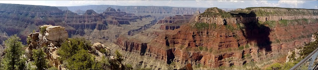
Bright Angel Point, the first part of the Canyon we saw. Click this to see the full-sized panorama picture.
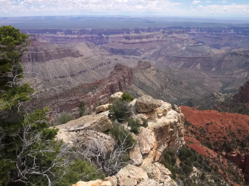
In Northern Arizona, the Colorado River has in the course of about 17 million years carved a really, really big hole in the ground. The Grand Canyon is 1857 meter (6093 feet) deep, 29 kilometer (18 miles) wide, 447 kilometer (277 miles) long and makes you feel very, very small.
Point Imperial, the highest point on the Rim.
Panorama of Point Imperial. Full-sized picture is here.
Today the Grand Canyon is one of the most popular tourist destinations of the World. It gets approximately 5 million visitors every year, which is funny to us, because that's also roughly the population of Finland. About 4,5 million only visit the southern rim of the canyon. This was one of the reasons we decided to visit the North Rim. It was crowded enough, too, even though we visited in June, before the busiest summer season. (A friend recommended North Rim, for which we're thankful. Thanks again, Ruth.)
A lot of wildlife can be seen in and near the Canyon, there are even bisons. We only saw deer and lizards.
The scenery in Grand Canyon is unbelievable. I found myself wondering if it actually is real, or a great hoax made with powerful computer graphics and advanced 3D projection technology?
Angel's Window vantage point. I think the name refers to the hole in the rock, visible on the right.
A baffling thing about the Grand Canyon is that in many places it would be easy to walk some 20 meter (60 feet) from the Rim without knowing that the Canyon is there. As we were driving on the scenic roads, there often was a forest on one side of the road, not unlike the forests in Finland, and a vertical half-mile drop on the other.
The view from Angel's Window pictured with a fisheye lens.
We spent one full day on the Canyon. That was enough to visit several vantage points in a relaxed pace. We also had time for a lunch in Grand Canyon Lodge. Food was good and not as horribly overpriced as I would have expected.

Walhalla vantage point.
Perhaps the most impressive thing we saw was the Grand Canyon sunset, observed from the balcony of the Lodge. We were smart enough to capture first-row seats early. The light and colors changed constantly as the sun descended. The view left us (but not the American tourists) speechless. The sunrise would probably be equally impressive, but since in June it takes place before 6 am we missed it.

The last rays of the setting sun.
In January, almost six months before our trip, I tried to book us a room on the North Rim within the National Park. Everything was fully booked. We ended up staying in Jacob Lake resort. Confusingly, there's no lake anywhere near it. The drive to the Canyon Rim took about one hour each way. When we returned, in the dark after sunset, things got a little scary. There were a lot of deer crossing the road, and even a cow and a calf. There was even a warning sign for bisons, but thankfully we saw none on the road.

A white-tailed Kaibab Squirrel in Jacob Lake. This kind of squirrel only lives near the North Rim of Grand Canyon. Squirrels on the south are different subspecies: the Canyon is an unbridgeable obstacle for squirrels.
We found Jacob Lake a nice place to stay. Prices were a little high, but so they are everywhere near attractions like Grand Canyon. Our cabin was comfortable, and the resort has a shop, a restaurant and a bakery. Chocolate and raspberry cookies get our highest recommendation. As experiences go they rival the Grand Canyon sunset. The cookies alone make Jacob Lake worth a stop! Sunset Amber Ale brewed by a local brewery was tasty.

The breakfast was not included in accommodation prices but featured lovely American-style pancakes with sponge like texture, so that they can absorb ridiculous amounts of delicious maple syrup. Those fortunate enough to have experienced an American breakfast know what I mean. Jacob Lake also offers lectures on things like landscape photography and history of the Navajo around Grand Canyon. Unfortunately we didn't have time to attend any.

We visited Grand Canyon on June 13th 2015.